One Thing to Know
Just 10,000 years ago Blue mountain was bare rock, just like you might see in the Rockies or Alaska today. As you ascend you can see how slowly soil accumulates at higher elevations. Near the start trail erosion reveals that the soil layer is 18-24 inches thick. Higher up, it's more like 6-12 inches. It takes a long time for soil to build up above 3000 feet in the Adirondacks.

The climb to the firetower on Blue Mountain provides great views of the lake country to the southwest and the High Peaks to the northeast. This might be the most challenging hike on our list so be prepared.
The summit of Blue Mountain is 3765 feet above sea level, making it the 66th highest mountain in the Adirondacks. From a starting point at nearly 2200 feet the 2.1 mile route ascends 1600 feet. That would be 800 feet of ascent per mile if the ascent was steady. But it’s not, the trail climbs at a gentle rate for the first three quarters of a mile. The grade then increases steadily and finally climbs steeply for the last half mile.
Blue Mountain is not a big climb by High Peaks standards, but it’s a big mountain for occasional hikers, and more than a few have been fooled by the ease of access. This is a mountain where a little preparation goes a long way and sturdy shoes, plenty of water, and persistence are needed to reach the top. Once you get there, the view is worth it. The view of Blue Mountain Lake is outstanding as is the view towards Tirrel Pond and with the High Peaks in the distance.
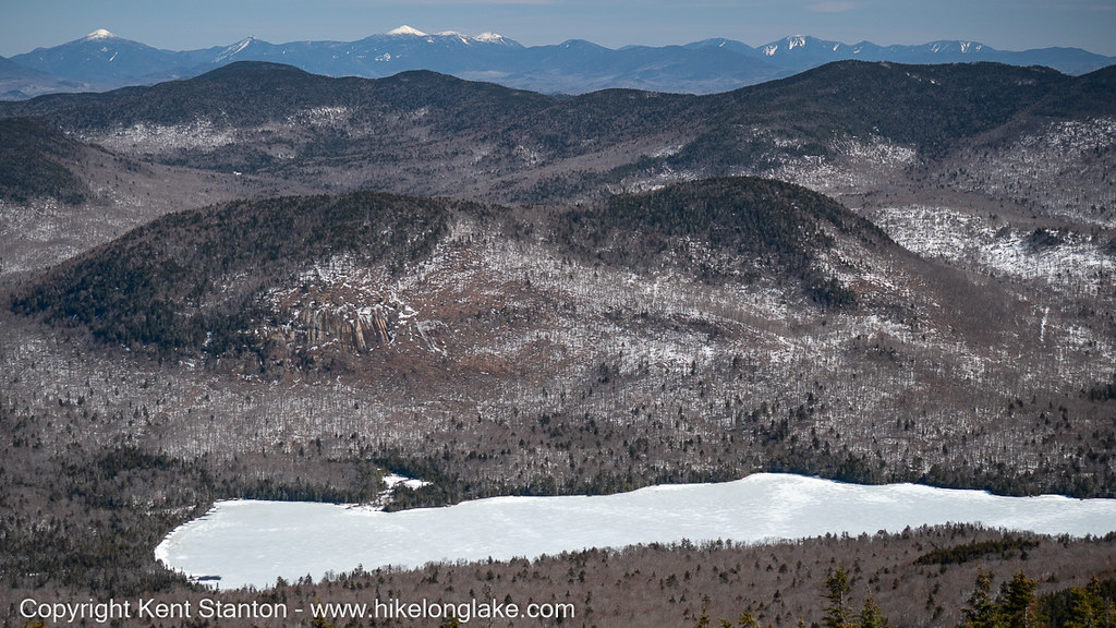
Tirrel Pond with the High Peaks in the distance
As you approach the top you enter the sub-alpine ecological zone. The harsh conditions result in a mix of stunted trees that is not generally found at lower elevations. Balsam Fir, Red and Black Spruce, and White Birch dominate this zone and you’ll see plenty of them along this route.
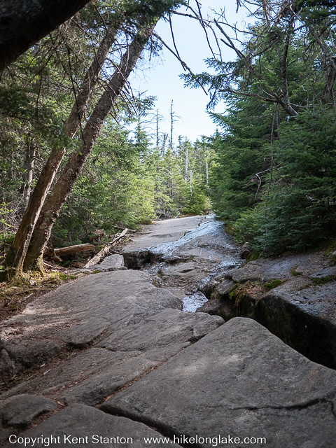
Trail erosion. Hikers have worn away the soil down to the bedrock. The soil at this location was originally 12-18 inches deep. There is even less soil near the top of the mountain.