One Thing to Know
New York State acquired the 19,000 acre Essex Chain Lakes complex from the Nature Conservancy in 2013. The management unit takes its' name from the ponds and small lakes that make up the Essex Chain.
The trail descends along the Goodnow River to its’ confluence with the Hudson. The route then twists along near the Hudson for a mile before climbing back to a trail junction near the start. The loop covers a total of 4.5 miles.

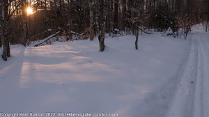
Along the North Hudson Ski Loop. Great conditions, late January 2021
The North Hudson Ski Loop descends about 200 feet from Goodnow Flow to the Hudson River. Designated as a ski trail (but also a good warm weather hike), most skiers follow the arrows that point the way to a counter-clockwise circuit of the loop. Going that way the trail descends towards the Hudson with the Goodnow river close by on your right. A couple of the drops are of moderate difficulty, but the grades are generally easy.
The middle stretch of the route, along the Hudson River, is the most difficult section for skiers. There are several short but steep ups and downs that can be tricky. After about .8 miles along the river, the route reaches an abandoned haul road that climbs back to the parking area.