One Thing to Know
Lower Sargent Pond supports a population of native Brook Trout and is a popular destination for fishermen. As you near the pond you pass a “fish barrier dam” on Boulder Brook. This lovely stream connects the Sargent Ponds with Raquette Lake and the fish dam blocks fish species that compete with the native Brook Trout from entering the pond.

Two attractive backcountry ponds that are easy to reach with good fishing and swimming.
There are three Sargent Ponds: Upper, Middle and Lower and two separate trailheads can be used to reach them. The two trailheads are located 1.3 miles apart on the North Point Road. A connector trail exists between the upper and lower ponds and this can be used to make a loop hike of around seven miles.
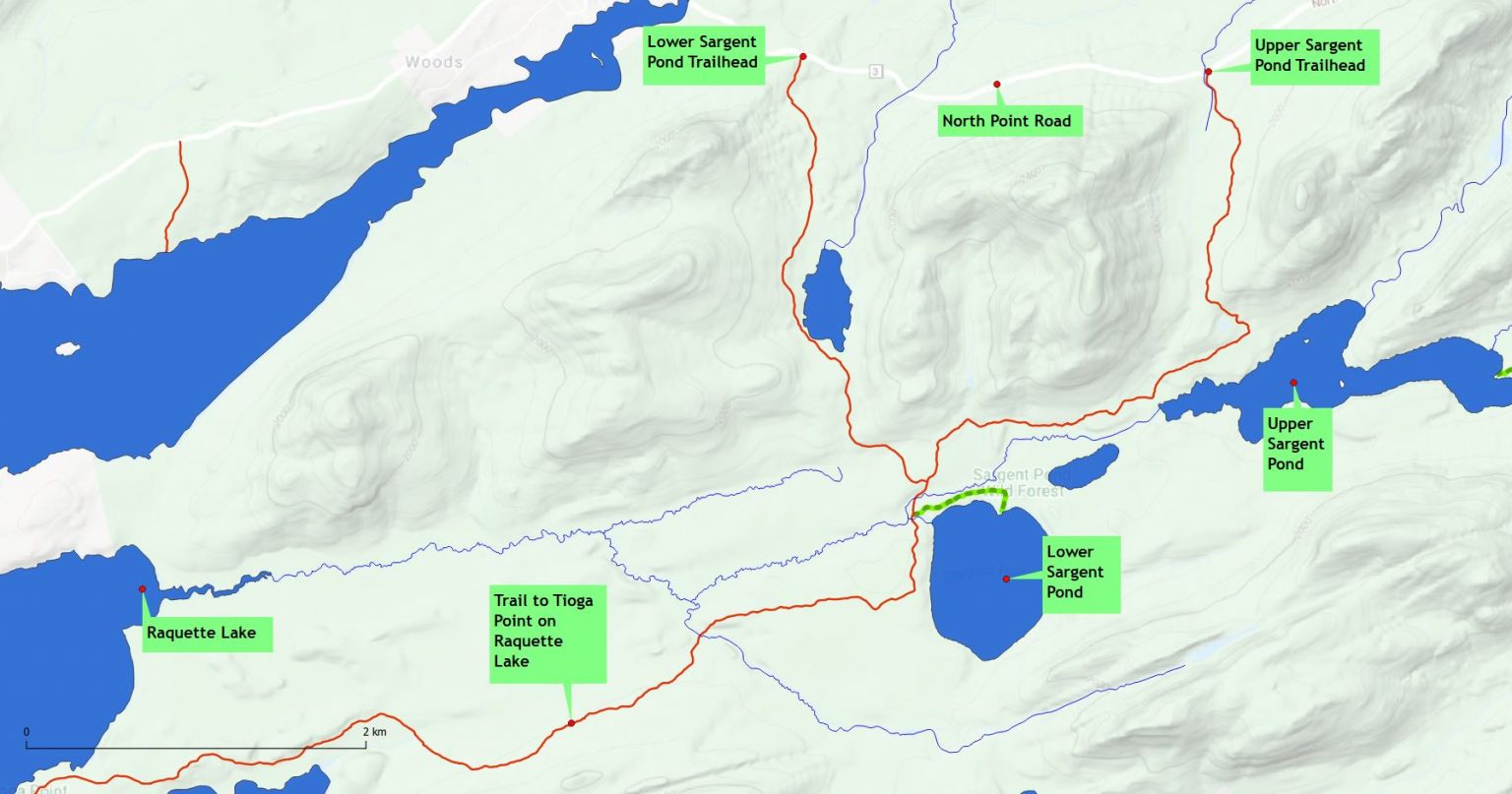
Map showing routes to Lower and upper Sargent Ponds

Along the trail to Lower Sargent Pond
The Upper Sargent Pond trailhead is located a little over six miles from the intersection of the North Point Road and Route 30. The trail covers just 1.3 miles and reaches the pond at a lovely spot that has been used for camping and picnicking for decades.
Lower Sargent is most easily reached from a separate trailhead located 1.3 miles further along the North Point Road (coming from Long Lake). It is a 2.3 mile walk to the shore of the pond, and an additional .3 miles to reach the popular lean-to located on north shore. The trail to Lower Sargent is somewhat rougher and more challenging than the Upper Sargent route, but it is still a relatively easy hike.
There is no formal trail to Middle Sargent Pond but it is reached by following an unmarked path that leaves the main trail near the Lower Sargent Lean-to.