

This is where locals take their friends to show off how great it is to live in the Adirondacks. An attractive walk to a view that elicits "wow" from all who see it.
| Directions | From Long Lake, drive north on Route 30 towards Tupper Lake. After about 13 miles turn left onto NY Route 421. Signs point the way to the 'Bog River and Lows Lake'. Follow 421 for approximately six miles until it turns to gravel. Continuing, the road follows the shore of Horseshoe Lake for an additional mile until it reaches a crossing of the abandoned tracks of the New York Central Railroad Adirondack Division. Cross the tracks and continue for .8 miles to a split in the road. The road continues to the right and the way left is blocked by a large gate. This is the start of the trail, there is room to park along the road near the gate. |
| Difficulty | Easy to Moderate. The round trip distance of 6.5 miles makes this a moderately difficult hike. The first 2.25 miles is on nearly flat gravel road (closed to public traffic). The route then ascends 400 feet by trail over the final mile. The road walk passes along the edge of Hitchens Pond Bog, one of the largest bogs in Adirondacks. This, and other interesting sights seen along the way, make this walk seem easier then the distance might imply. |
| Family-Friendly | Yes, but plan for a full day. |
| Winter | Yes and No. The road portion of the Overlook route would make a fine ski route and expert skiers might even try the steeper trail up to the overlook. The entire route is suitable for snowshoeing. The difficulty is that the road to the trailhead is not plowed past the Horseshoe Lake snow plow turnaround. Starting from there adds two miles (each way) to a trip to the overlook. Making it 10+ mile round trip. |
| One Thing to Know | The dam you pass at the base of the ridge is known as Lows Upper Dam. The original dam was built in 1907 as part of AA Low's attempt to create a profitable forest industries operation on 15,000 acres he owned in the area. The upper dam creates Lows Lake, the large body of water west of the overlook ridge. |
| NY DEC Webpage | Horseshoe Lake Wild Forest |
| Photo Gallery | Hichens Pond Overlook Photo Gallery |
The view of Hitchins Pond, and the Bog River, from Hitchens Pond Overlook is stunning. That's the bottom line for this hike. The route starts out following a gravel road (closed to public traffic) and within a short distance the Hitchins Pond Bog --one of the largest boreal bogs in the northeastern United States-- appears through the trees. At about .7 miles the road crosses the bog on a causeway and the route then moves away from the bog. It's worth noting that this hike might not be a great choice on a warm, still, day in June or July. Biting bugs love bogs and they love hikers. Continuing, the road passes a series of lovely wetlands and streams and Hichins pond is nearby for much of the way. After 2.25 miles along the road you reach the site of Lows Upper Dam. The trail leaves the clearing at the dam on the right (there is a sign) and the overlook is visible on top of the ridge. From here, you follow a forest trail for one mile. The climb is 400 feet and the route climbs steadily, but mostly gently, for the entire distance. At the top you come upon the open ledges of the overlook unexpectedly, and even hardened hikers have been known to gasp at the view. On a late summer or fall day this view is as good as anything you'll see, anywhere.
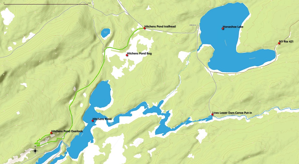
Hitchens Pond Overlook Map
Hitchens Pond Overlook View
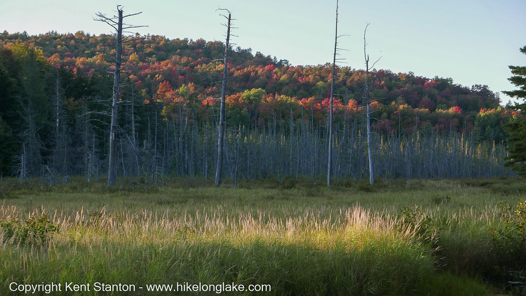
Along the trail to Hitchens Pond Overlook