
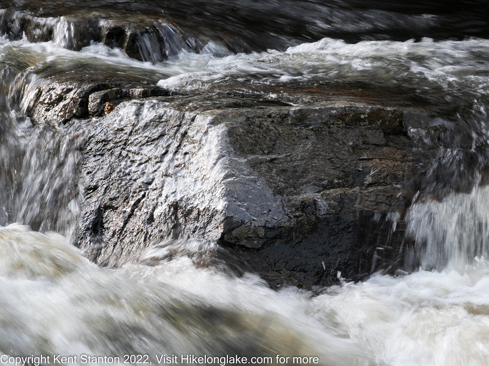
Indian Lake: An easy walk along the Cedar River to a small falls with a nice overlook.
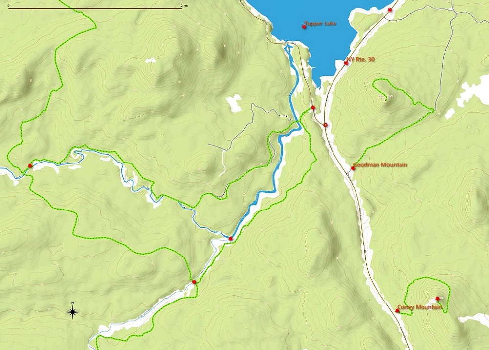
| Directions | In Indian Lake, head north on Pelon Road (past the Library). When the road splits stay to the right on Pelon Road and follow it to the end. The road ends at the capped Indian Lake landfill and there is plenty of parking there. The trail along the river passes straight out of the back of the parking lot past a gate (heading northwest). The loop trail starts at the same place but heads off to the northeast passing a trail register. That is also the start of the trail to Elm Island. |
| Difficulty | Easy. It's a 3 mile round trip out and back along the river. Or, make it a loop hike that is slightly longer and goes over a small ridge. There are a couple of wet areas along the Cedar River but these can be crossed on the beaver dams that flooded the trail. |
| Family-Friendly | Yes, the Cedar River is attractive and there are nice spots for swimming in the summer. The area around the falls has steep drop-offs so keep an eye on small children. |
| Winter | The loop trail is commonly skied but the way along the river has a couple of spots that might be tricky. |
| One Thing to Know | |
| DEC Website Page | Blue Mountain Wild Forest |
| Photo Gallery | Pashley Falls Photo Gallery |
Pashley Falls Trail Map
In Indian Lake, head north on Pelon Road (past the Library). When the road splits stay to the right on Pelon Road and follow it to the end. The road ends at the capped Indian Lake landfill and there is plenty of parking there. The trail along the river passes straight out of the back of the parking lot past a gate (heading northwest). The loop trail starts at the same place but heads off to the northeast passing a trail register. That is also the start of the trail to Elm Island.