
An easy hike to one of the best waterfalls in the Adirondacks. Longer loop trips are also possible.
| Directions | From Long Lake, drive north on Route 30 towards Tupper Lake. After about 13 miles turn left onto NY Route 421. Signs point the way to the “Bog River and Lows Lake. The two parking areas are somewhat obscure. The First parking location is just 200 yards from the intersection of Routes 30 and 421 (on the west side of 421). Two stone pillars and a heavy yellow gate mark the spot. There is room for three or four cars near the gate, and you can park along the road. The second location is further along on Route 421. Drive for 2.8 miles on 421 and look for a narrow opening in the trees on the left (south side of the road) with a gate. There is room for several cars along the road near the gate. A small, informal, sign that reads “Winding Falls” is tacked to a tree. But this is hard to see from the road. |
| Difficulty | Moderate; There are three possible routes. An easy five mile in and out route, a longer in-and-out route that follows the Bog River, a more difficult seven mile loop that requires some route finding along old logging roads. |
| Family-Friendly | Yes, for older children. The 421 trailhead and Goodman Bridge Trails are easy out-and-back hikes with gentle grades. |
| Winter | All three of the described trails are marked as ski trails and all three would make good routes for skiing or snowshoeing. |
| One Thing to Know | Winding Falls is also known as Pa's falls. 'Pa' was Hebe Costello, who leased a camp near the falls until his death in 1979 (Discover the Northwest Adirondacks, McMartin and Ingersoll). After his death, his family placed memorial stones near the falls. |
| NY DEC Webpage | Horseshoe Lake Wild Forest |
| Photo Gallery | Winding Falls Photo Gallery |
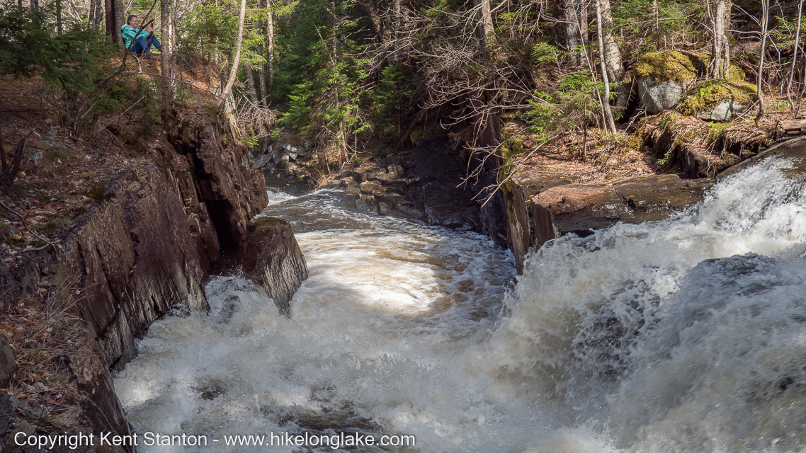
Winding Falls on the Bog River is among the best waterfalls in the Adirondacks. But, until recently no formally marked trails reached the falls and it remains relatively unknown. This is no longer case and three separate trails now go to Winding Falls. Two of them leave from the same trailhead and can be combined to make an outstanding loop hike (or ski) of a little over seven miles.
Winding Falls
Each of the three trails that reach Winding Falls has a distinct character. And even without the falls, each would be well-worth the modest effort required to walk them.
These trails lack formal names, so we've given them names so you can tell them apart on the map.
- The Rte 421 Winding Falls Trail: This is the shortest and easiest route, covering 2.75 miles (one-way) with a modest 250 foot elevation differential. Much of this route follows old logging roads that make for smooth and easy walking. The first two miles of the route pass through young hardwood forests that were logged in the last 50 years. The forests are not particularly appealing, but wildlife and birds are abundant. A highlight of this route is the extensive complex of beaver dams and ponds less than a mile from the road. Young beech and birch dominate the surrounding forest and this must look like an all-you-can-eat buffet to the local beaver population. They have worked extra hard to take advantage of this food supply. This trail leaves Route 421 (on the left) a little less than three miles from the intersection with Route 30.
- Two trails reach the falls from a pullout on Rte. 421 just 250 yards from the intersection with Route 30. This is known locally as the "Goodman Bridge Trailhead" after the large concrete bridge that crosses the Bog River less than a quarter mile in. The Goodman Bridge Trail starts at this location and crosses the bridge. Turning left after crossing the bridge the trial is marked with blue and red ski trail markers all the way to the falls. This approach is 3.5 miles (one-way) but this is probably the most scenic of the three approaches to the falls.
- The Round Lake Stream Trail starts at the same location but, instead of crossing the bridge, continue straight ahead following yellow ski trail markers. A little over a mile from the trailhead this route passes the confluence of the Bog River and Round Lake Stream. Continuing past the confluence for another half mile you'll pass a falls and then reach a bridge over Round Lake stream. Cross this bridge and bear right where the road splits on the other side. This section follows a very well built (now abandoned) logging road. It is not marked but it is easily followed. This road section covers 1.7 miles, crossing a small ridge before dropping down to a second bridge, this time over the Bog River. The three trails described here converge at that point. This trail, combined with with the Goodman Bridge Trail, makes for a loop of about seven miles.

Winding Falls Trail Map
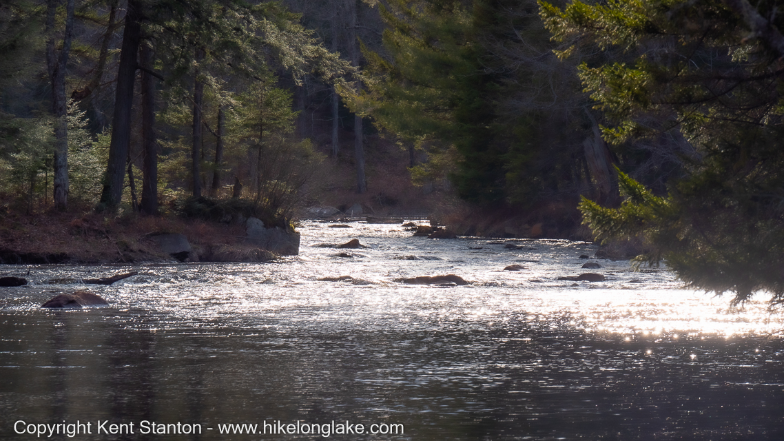
The Bog River below winding falls
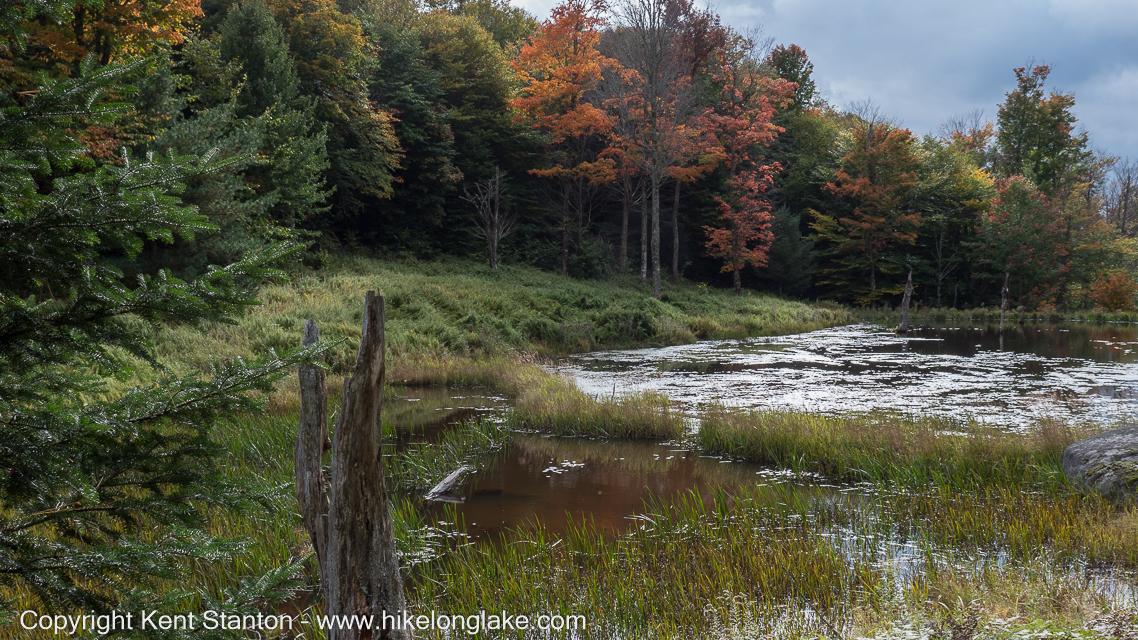
Beaver have flooded a small valley passed on the way to Winding Falls
Beaver have built a series of dams in a small valley that is passed on the '421 route'. That is not unusual on its own, but what is unusual is the extent of the area cleared around the ponds. Beaver find the stands of young Birch and Beech that dominate this section of forest irresistible and they have been feasting.